Portal:Tropical cyclones
The Tropical Cyclones Portal
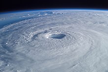
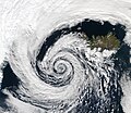
A tropical cyclone is a storm system characterized by a large low-pressure center, a closed low-level circulation and a spiral arrangement of numerous thunderstorms that produce strong winds and heavy rainfall. Tropical cyclones feed on the heat released when moist air rises, resulting in condensation of water vapor contained in the moist air. They are fueled by a different heat mechanism than other cyclonic windstorms such as Nor'easters, European windstorms and polar lows, leading to their classification as "warm core" storm systems. Most tropical cyclones originate in the doldrums, approximately ten degrees from the Equator.
The term "tropical" refers to both the geographic origin of these systems, which form almost exclusively in tropical regions of the globe, as well as to their formation in maritime tropical air masses. The term "cyclone" refers to such storms' cyclonic nature, with anticlockwise rotation in the Northern Hemisphere and clockwise rotation in the Southern Hemisphere. Depending on its location and intensity, a tropical cyclone may be referred to by names such as "hurricane", "typhoon", "tropical storm", "cyclonic storm", "tropical depression" or simply "cyclone".
Types of cyclone: 1. A "Typhoon" is a tropical cyclone located in the North-west Pacific Ocean which has the most cyclonic activity and storms occur year-round. 2. A "Hurricane" is also a tropical cyclone located at the North Atlantic Ocean or North-east Pacific Ocean which have an average storm activity and storms typically form between May 15 and November 30. 3. A "Cyclone" is a tropical cyclone that occurs in the South Pacific and Indian Oceans.
Selected named cyclone -
Hurricane Agatha was the strongest hurricane to make landfall along the Pacific coast of Mexico in the month of May since records began in 1949. The first named storm and the first hurricane of the 2022 Pacific hurricane season, Agatha originated from a surface trough south of the Gulf of Tehuantepec. It steadily organized into a tropical depression early on May 28 and within hours intensified into Tropical Storm Agatha. Amid favorable environmental conditions, the cyclone underwent rapid intensification on May 29, strengthening into a Category 2 hurricane and reaching peak winds of 110 mph (180 km/h). Though the storm moved west-northwest early on, it curved toward the northeast in response to weakening high pressure over Mexico. On the afternoon of May 30, the hurricane made landfall just west of Puerto Ángel, Oaxaca, with slightly weaker winds of 105 mph (169 km/h).
Agatha weakened rapidly as it moved inland, and soon dissipated. Heavy rain brought by the storm triggered landslides and flash flooding, killing at least 9 and left 6 missing in Oaxaca. Aon estimated that total losses reached at least $50 million (2022 USD), with the National Hurricane Center later saying, “no monetary damage figures are currently available.” (Full article...)Selected article -

A typhoon is a tropical cyclone that develops between 180° and 100°E in the Northern Hemisphere and which produces sustained hurricane-force winds of at least 119 km/h (74 mph). This region is referred to as the Northwestern Pacific Basin, accounting for almost one third of the world's tropical cyclones. The term hurricane refers to a tropical cyclone (again with sustained winds of at least 119 km/h (74 mph)) in the north central and northeast Pacific, and the north Atlantic. In all of the preceding regions, weaker tropical cyclones are called tropical storms. For organizational purposes, the northern Pacific Ocean is divided into three regions: the eastern (North America to 140°W), central (140°W to 180°), and western (180° to 100°E). The Regional Specialized Meteorological Center (RSMC) for tropical cyclone forecasts is in Japan, with other tropical cyclone warning centres for the northwest Pacific in Hawaii (the Joint Typhoon Warning Center), the Philippines, and Hong Kong. Although the RSMC names each system, the main name list itself is coordinated among 18 countries that have territories threatened by typhoons each year.
Within most of the northwestern Pacific, there are no official typhoon seasons as tropical cyclones form throughout the year. Like any tropical cyclone, there are several main requirements for typhoon formation and development. It must be in sufficiently warm sea surface temperatures, atmospheric instability, high humidity in the lower-to-middle levels of the troposphere, have enough Coriolis effect to develop a low pressure centre, a pre-existing low level focus or disturbance, and a low vertical wind shear. Although the majority of storms form between June and November, a few storms may occur between December and May (although tropical cyclone formation is very rare during that time). On average, the northwestern Pacific features the most numerous and intense tropical cyclones globally. Like other basins, they are steered by the subtropical ridge towards the west or northwest, with some systems recurving near and east of Japan. The Philippines receive the brunt of the landfalls, with China and Japan being less often impacted. However, some of the deadliest typhoons in history have struck China. Southern China has the longest record of typhoon impacts for the region, with a thousand-year sample via documents within their archives. Taiwan has received the wettest known typhoon on record for the northwest Pacific tropical cyclone basins. However, Vietnam recognises its typhoon season as lasting from the beginning of June through to the end of November, with an average of four to six typhoons hitting the country annually. (Full article...)Selected image -

Selected season -

The 1983 Atlantic hurricane season was the least active Atlantic hurricane season since 1930. The season officially began on June 1, 1983, and lasted until November 30, 1983. These dates conventionally delimit the period of each year when most storms form in the Atlantic basin. The season had very little activity, with only seven tropical depressions, four of which reached tropical storm strength or higher. This led to the lowest accumulated cyclone energy count since 1977.
The season began later than normal; the first tropical depression formed on July 23 and the second on July 27. Neither tropical depressions strengthened and they dissipated soon thereafter. Hurricane Alicia formed as Tropical Depression Three on August 15, quickly intensified into a hurricane on August 16 and made landfall in Texas on August 18. Alicia caused $3 billion in damage in Texas. Hurricane Barry formed on August 25, crossed Florida and strengthened into a hurricane. Barry made landfall near the Mexico–United States border, and dissipated over land on August 30. (Full article...)Related portals
Currently active tropical cyclones

Italicized basins are unofficial.
- North Atlantic (2024)
- No active systems
- East and Central Pacific (2024)
- No active systems
- West Pacific (2024)
- No active systems
- North Indian Ocean (2024)
- No active systems
- Mediterranean (2023–24)
- No active systems
- South-West Indian Ocean (2023–24)
- No active systems
- Australian region (2023–24)
- No active systems
- South Pacific (2023–24)
- No active systems
- South Atlantic (2023–24)
- No active systems
Last updated: 21:50, 2 June 2024 (UTC)
Tropical cyclone anniversaries

June 8
- 1960 - Typhoon Mary struck Hong Kong, killing 1,649 people across southeastern China.
- 1966 - Hurricane Alma made landfall in western Cuba causing severe flooding. The storm killed a total of 90 people and caused over $200 million of damage.

June 9
- 1934 - A hurricane struck what is now Belize after looping across Central America. The storm killed at least 516 people along its path.
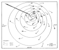
- 1989 - Typhoon Dot (track pictured) reached peak strength as a Category 3 while nearing landfall over in Hainan, causing 8 deaths and CN¥170 million (US$45.1 million) of damages.
- 1998 - A cyclone struck the Indian state of Gujarat, killing at least 4,000 people.

June 10
- 1974 - Typhoon Dinah made landfall on the island of Luzon in the Philippines. Dinah killed 73 people in the Philippines, Hainan and Vietnam.
- 1991 - Cyclone Gritelle (pictured) became a named system, making it the strongest system within the south-west Indian Ocean to form in the month of June, as well as the latest in the cyclone year to be properly named.
Did you know…


- …that the Joint Typhoon Warning Center considers that Typhoon Vera (pictured) of 1986 is actually two distinct systems, formed from two separated low-level circulations?
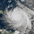
- …that Hurricane Agatha (pictured) was the strongest Pacific hurricane to make landfall in Mexico in May since records began in 1949?
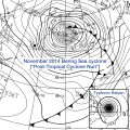
- …that Cyclone Raquel (track pictured) travelled between the Australian and South Pacific basins between the 2014–15 and 2015–16 seasons, spanning both seasons in both basins?
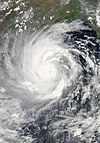
- …that Cyclone Amphan (pictured) in 2020 was the first storm to be classified as a Super Cyclonic Storm in the Bay of Bengal since 1999?
General images -

Category 4, the second-highest classification on the Saffir–Simpson Hurricane Scale, is used for tropical cyclones that have winds of 130–156 mph (209–251 km/h; 113–136 kn). The division of the eastern and central Pacific basins occurs at 140° W; the eastern Pacific covers area east of 140° W, while the central Pacific extends between 140° W to 180° W. Both basins' division points are at 66° N as a northern point and the equator as the southern point. , 141 hurricanes have attained Category 4 status in the northeastern Pacific basins. This list does not include storms that also attained Category 5 status on the scale.
Numerous climatological factors influence the formation of hurricanes in the Pacific basins. The North Pacific High and Aleutian Low, usually present between January and April, cause strong wind shear and unfavorable conditions for the development of hurricanes. During its presence, El Niño results in increased numbers of powerful hurricanes through weaker wind shear, while La Niña reduces the number of such hurricanes through the opposite. Global warming may also influence the formation of tropical cyclones in the Pacific basin. During a thirty-year period with two sub-periods, the first between 1975 and 1989 and the second between 1990 and 2004, an increase of thirteen Category 4 or 5 storms was observed from the first sub-period.
(Full article...)Topics
Subcategories
Related WikiProjects
WikiProject Tropical cyclones is the central point of coordination for Wikipedia's coverage of tropical cyclones. Feel free to help!
WikiProject Weather is the main center point of coordination for Wikipedia's coverage of meteorology in general, and the parent project of WikiProject Tropical cyclones. Three other branches of WikiProject Weather in particular share significant overlaps with WikiProject Tropical cyclones:
- The Non-tropical storms task force coordinates most of Wikipedia's coverage on extratropical cyclones, which tropical cyclones often transition into near the end of their lifespan.
- The Floods task force takes on the scope of flooding events all over the world, with rainfall from tropical cyclones a significant factor in many of them.
- WikiProject Severe weather documents the effects of extreme weather such as tornadoes, which landfalling tropical cyclones can produce.
Things you can do
 |
Here are some tasks awaiting attention:
|
Wikimedia
The following Wikimedia Foundation sister projects provide more on this subject:
-
Commons
Free media repository -
Wikibooks
Free textbooks and manuals -
Wikidata
Free knowledge base -
Wikinews
Free-content news -
Wikiquote
Collection of quotations -
Wikisource
Free-content library -
Wikiversity
Free learning tools -
Wikivoyage
Free travel guide -
Wiktionary
Dictionary and thesaurus


